On the Historic England web site you can find several old maps of Alnwick. These images seem to have been acquired by Historic England via the Royal Commission on the Historical Monuments of England, but it looks as though the original maps belong to the Duke of Northumberland.
The pinfold no longer stands where it was in 1788, but it’s interesting to see how names have changed, and to trace how much of today’s townscape was shaped by those burgage plots and the surrounding fields. Follow the links to examine these at high resolution.
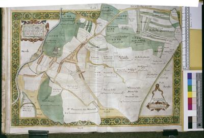
A map of Alnwick, including the town and castle by Sheephouse, from 1624. View it on the Historic England site <here>.

A plan of the town and castle of Alnwick, 1760 by Thompson. View it on the Historic England web site <here>
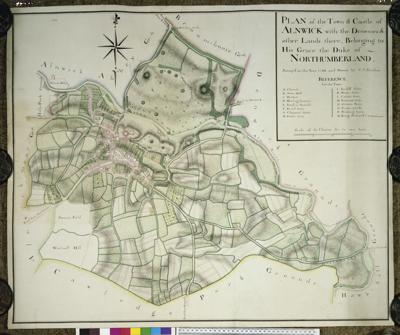
Plan of the town and castle of Alnwick, 1788 by C. J. Sauthier. View it on the Historic England Site <here>.
