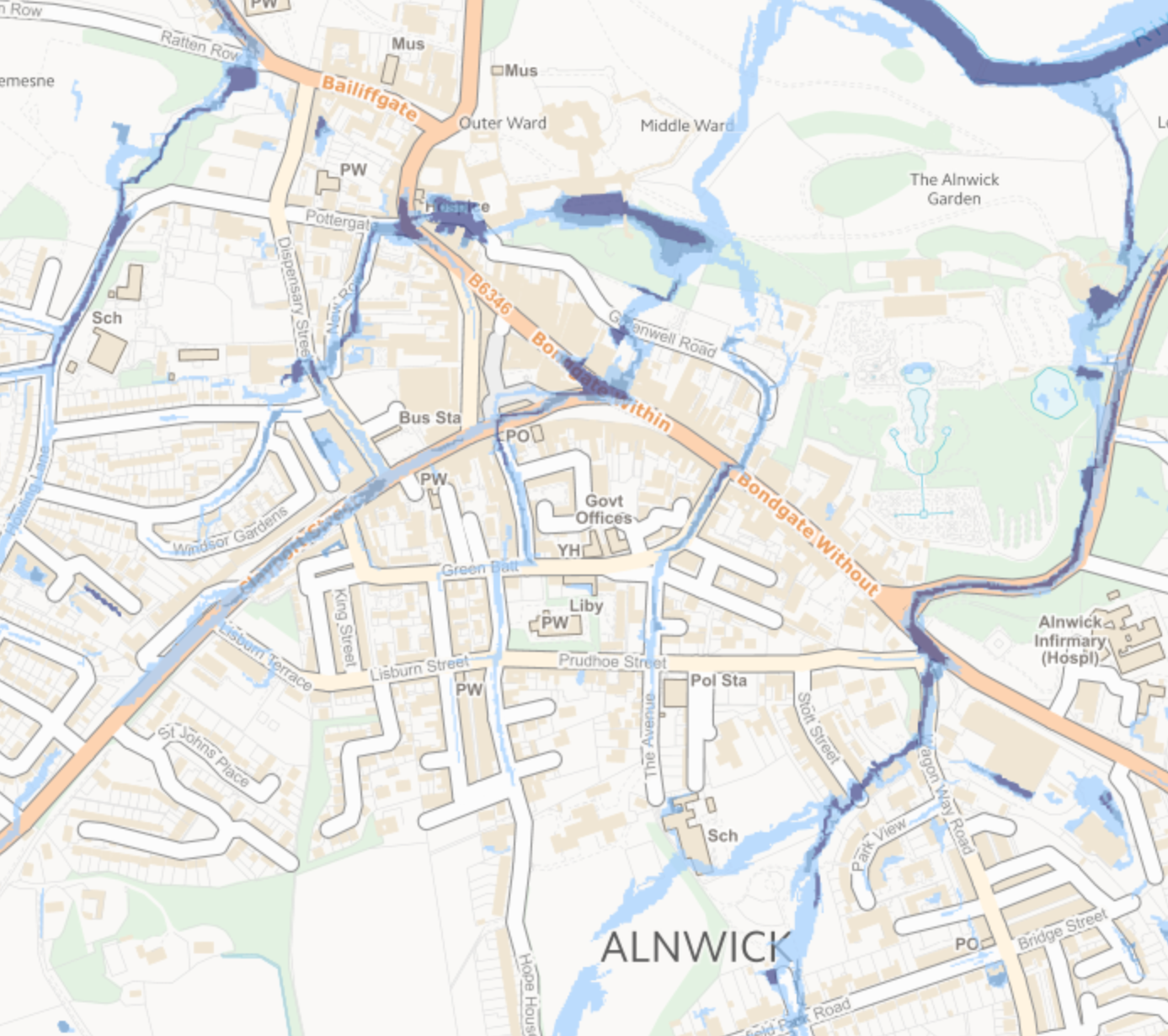
The Environment Agency provides a map of flood risks across the country <here>. This extract for part of Alnwick shows a detailed view of the extent of high, medium and low flood risk from surface water. There are options for different degrees of risk from reservoirs, sea and rivers, water velocity and depth. We suspect few members will discover anything surprising, but we hope you’ll find it interesting to explore, as well as a topical reminder.
