The Office of National Statistics has recently published a set of maps showing their estimates of the distance we can travel by public transport and on foot.
They produced their estimates using a mix of routing software and public transport schedules for Tuesday 15th November 2022, between 7:15am and 9:15am.
The approach is experimental. It will be evaluated, and may change. The ONS is publishing these results (with a number of caveats) so that they can collect feedback on quality and suitability, and make improvements.
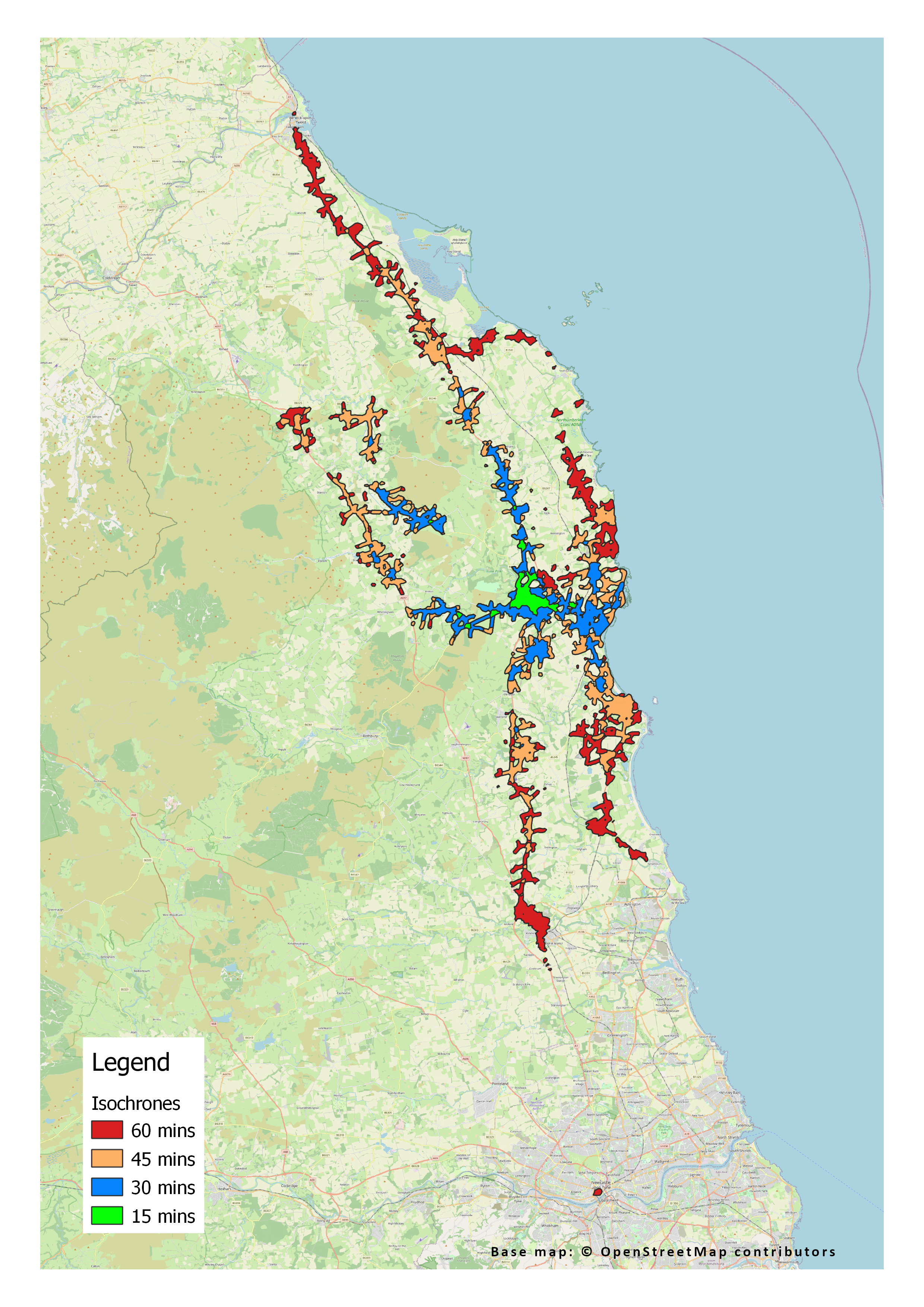
The image below shows their estimates for journeys starting in the centre of Alnwick. It suggests that central Newcastle, the area around Berwick station, Morpeth and Seahouses can all be reached within an hour. Wooler, Amble and Craster can be reached in 45 minutes; Shilbottle and Alnmouth in 30 minutes. The time to reach other destinations depends on distance along the A1 and other major routes. It shows no way to reach Rothbury, any major hospital or any Further Education College within an hour on public transport.
Does this ring true?
More details here – https://tinyurl.com/2v7za6fv
.
